Introduction
Planning for water supplies began in Prescott’s territorial times (1860s). Now, looking to the future, the City will again assess the water supplies and its customer’s water demands. The plan intends to provide continuity, stability, and will be subject to regular updates.
Purpose: By focusing on infrastructure, distribution and delivery, conservation and safety, the community will experience safe potable water within the water service area boundary. (City Council Strategic Plan FY2025-2029)
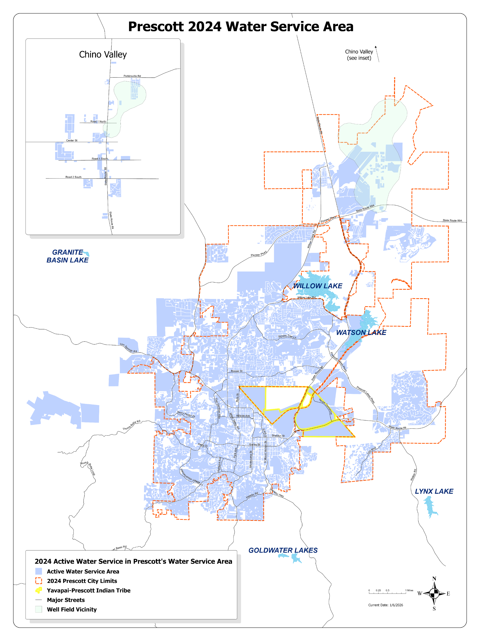
Water Service Area Map
Arizona Revised Statute (A.R.S. § 45-402.31) defines the term service area as: “The area of land actually being served water for non-irrigation use by a city, town or private water company plus additions to such area which contain an operating distribution system owned by the city, town or private water company primarily for the delivery of water for a non-irrigation use.” The map below depicts Prescott’s water service area as of 2024.
Timeline
-
Timeline item 1 - complete
Nov 2024- Dec 2024: Plan Prework
- Determine Consultants
- Establish staff and stakeholder work groups
- Determine existing and needed information
-
Timeline item 2 - active
Jan 2025- Dec 2025: Planning Process
- Consultant contracting
- Staff and Stakeholder Engagement
- Finalize outline
- Supplies
- Demands
- Strategies
- Draft Actions/Implementations
-
Timeline item 3 - incomplete
Jan 2026- Dec 2026: Evaluate Water Managment Options
- Stakeholder workshops/reviews
- Draft final report
- Final report
Public Meetings
May 5, 2026 - Council Subcommittee for Water Issues (agenda packet only, no video, meeting cancelled)
February 17, 2026 - Council Special Study Session
February 3, 2026 - Council Subcommittee for Water Issues
November 18, 2025 - Council Study Session
September 2, 2025 - Council Subcommittee for Water Issues
July 1, 2025 - Council Subcommittee for Water Issues


